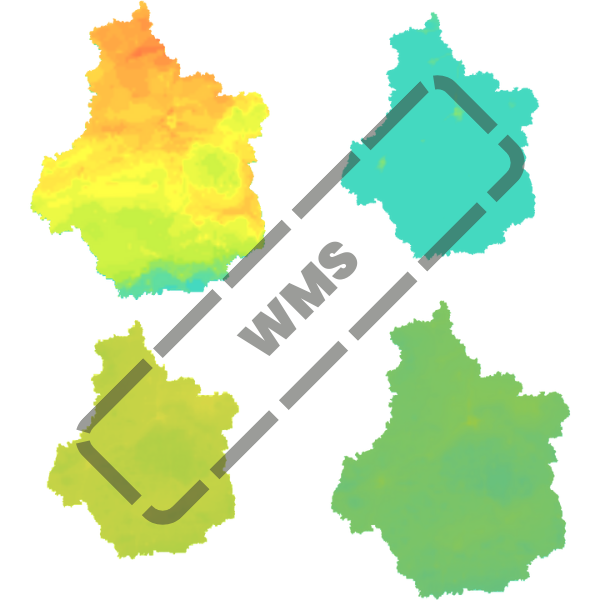
Service WMS - Domaines / Thèmes / Concentrations cartographiées
Service WMS du domaine Domaines / Thèmes / Concentrations cartographiées
Simple
Identification info
- Date (Creation)
- 2023-10-09
- Theme
-
- OGC:WMS
- Service Type
- view
- Service Version
- -- Version du service WMS --
- Description
- -- Description de l'étendue géographique (eg France métropolitaine) --
N
S
E
W
))
- Coupling Type
- Tight
Contains Operations
- Operation Name
- GetCapabilities
- Distributed Computing Platforms
- Web services
- Connect Point
- https://datacarto.opendata-ligair.fr/wms_sdom/modelisation?service=WMS&request=GetCapabilities ( OGC:WMS-1.1.1-http-get-map )
Contains Operations
- Operation Name
- GetMap
- Distributed Computing Platforms
- Web services
- Connect Point
- https://datacarto.opendata-ligair.fr/wms_sdom/modelisation?service=WMS&request=GetCapabilities ( OGC:WMS-1.1.1-http-get-map )
Contains Operations
- Operation Name
- GetFeatureInfo
- Distributed Computing Platforms
- Web services
- Connect Point
- https://datacarto.opendata-ligair.fr/wms_sdom/modelisation?service=WMS&request=GetCapabilities ( OGC:WMS-1.1.1-http-get-map )
Coupled Resource
- Operation Name
- GETMAP
- Identifier
- 6aa70c2e-5b56-4ad1-8164-9e0694ee388e
Coupled Resource
- Operation Name
- GETMAP
- Identifier
- 6aa70c2e-5b56-4ad1-8164-9e0694ee388e
Coupled Resource
- Operation Name
- GETMAP
- Identifier
- 6aa70c2e-5b56-4ad1-8164-9e0694ee388e
Coupled Resource
- Operation Name
- GETMAP
- Identifier
- 6aa70c2e-5b56-4ad1-8164-9e0694ee388e
Coupled Resource
- Operation Name
- GETMAP
- Identifier
- 6aa70c2e-5b56-4ad1-8164-9e0694ee388e
Coupled Resource
- Operation Name
- GETMAP
- Identifier
- 1f9defa6-7bd5-490a-87de-127e7188e81d
Coupled Resource
- Operation Name
- GETMAP
- Identifier
- 1f9defa6-7bd5-490a-87de-127e7188e81d
Coupled Resource
- Operation Name
- GETMAP
- Identifier
- 1f9defa6-7bd5-490a-87de-127e7188e81d
Coupled Resource
- Operation Name
- GETMAP
- Identifier
- 1f9defa6-7bd5-490a-87de-127e7188e81d
Coupled Resource
- Operation Name
- GETMAP
- Identifier
- 1f9defa6-7bd5-490a-87de-127e7188e81d
Coupled Resource
- Operation Name
- GETMAP
- Identifier
- 8ac20bbe-0dbb-4283-a0e4-c502b6a82bbb
Coupled Resource
- Operation Name
- GETMAP
- Identifier
- 8ac20bbe-0dbb-4283-a0e4-c502b6a82bbb
Coupled Resource
- Operation Name
- GETMAP
- Identifier
- 8ac20bbe-0dbb-4283-a0e4-c502b6a82bbb
Coupled Resource
- Operation Name
- GETMAP
- Identifier
- 8ac20bbe-0dbb-4283-a0e4-c502b6a82bbb
Coupled Resource
- Operation Name
- GETMAP
- Identifier
- 8ac20bbe-0dbb-4283-a0e4-c502b6a82bbb
Coupled Resource
- Operation Name
- GETMAP
- Identifier
- 8ac20bbe-0dbb-4283-a0e4-c502b6a82bbb
Coupled Resource
- Operation Name
- GETMAP
- Identifier
- 8ac20bbe-0dbb-4283-a0e4-c502b6a82bbb
Coupled Resource
- Operation Name
- GETMAP
- Identifier
- 8ac20bbe-0dbb-4283-a0e4-c502b6a82bbb
Coupled Resource
- Operation Name
- GETMAP
- Identifier
- da8079a5-487b-4253-90fe-b805e95fe78f
Coupled Resource
- Operation Name
- GETMAP
- Identifier
- da8079a5-487b-4253-90fe-b805e95fe78f
Coupled Resource
- Operation Name
- GETMAP
- Identifier
- da8079a5-487b-4253-90fe-b805e95fe78f
Coupled Resource
- Operation Name
- GETMAP
- Identifier
- da8079a5-487b-4253-90fe-b805e95fe78f
- Operates On
-
- Niveaux annuels en PM25 dans l'air ambiant issus de la modélisation sur la région Centre-Val de Loire
- Niveaux annuels en PM10 dans l'air ambiant issus de la modélisation sur la région Centre-Val de Loire
- Nombre de jours annuels de dépassement de 120µg/m3 sur 8 heures en Ozone issu de la modélisation sur la région Centre-Val de Loire
- Niveaux annuels en dioxyde d'azote dans l'air ambiant issus de la modélisation sur la région Centre-Val de Loire
- Reference system identifier
- EPSG / RGF93 / Lambert-93 (EPSG:2154) / 7.4
- OnLine resource
-
Accès au service WMS
(
application/vnd.ogc.wms_xml
)
Accès au service WMS
- Hierarchy level
- Service
- File identifier
- 1b5ebd37-8ede-4f12-833a-43de368b7abe XML
- Metadata language
- fre
- Character set
- UTF8
- Hierarchy level
- Service
- Hierarchy level name
- Service
- Date stamp
- 2024-07-25T12:07:24
- Metadata standard name
- ISO 19115:2003/19139
- Metadata standard version
- 1.0
Overviews

Spatial extent
N
S
E
W
))
Provided by

Associated resources
Not available
 Do.TeRR